Built by jidienne.com
Farmers2,997 nodes
ProgrammeCarbon Contract
StatusActive
Protocol
AWD + Field Sensors
Area
~1,430 km²
Status
Active
ProtocolAWD + Field Sensors
Area~1,280 km²
StatusActive
SIREN · Live
Satellite Monitoring
Punjab, Pakistan · 10 Districts
Coverage Area
~1.2M ha
Monitoring Zones
10 districts
Orbit / Pass Freq.
Sentinel-1 · 6 days
Anomalies Detected
3 zones elevated
Last Satellite Pass
—
CH₄ Intensity
High risk
Elevated
Within target
Satellite + sensor fusion across 3,000+ farmer plots
NDVI · Crop Vigor
Stressed
Vigorous
82%
Avg Health
3,241
Active Plots
14
Alerts
‹
Kissan Dost
Rice Partners Pvt Ltd – RPL
⋮
Message
Flooded
Draining
Dry
Sensor Node
0
Sensors Deployed
0
Farms Monitored
0%
Network Uptime
AWD Cycle — Water Level (cm)
CH₄ flux
100%
Mill
Rice moves through certified supply chains, clean data intact.
Farm
A smallholder farmer adopts AWD tracked, verified, real.
Buyer
A brand or credit buyer receives product they can stand behind.
Farm
A smallholder farmer adopts AWD tracked, verified, real.
Mill
Rice moves through certified supply chains, clean data intact.
Buyer
A brand or credit buyer receives product they can stand behind.
Farmer
Practice
Practice
AWD water management logged per field
Optional
SCRAM Field
Sensors
Sensors
Optional
Deployed when IoT sensors are on-site. Adds live soil & water readings to the evidence base.
Optional
SIREN
Satellite
Satellite
Optional
Used when satellite coverage is available. Cross-validates flood/dry cycles from orbit.
Optional
CROPCHECK
Data Model
Data Model
Optional
Applied when deeper modeling is required. Calculates per-field emission reductions at higher precision.
Gold Standard
Verification
Verification
Independent third-party audit against GS4GG
Carbon Credit
Issued
Issued
Certified reductions delivered to market
1
Farmers adopt AWD
Reduce water & emissions
Step 1
Farmers switch to Alternate Wetting & Drying — a proven technique that cuts methane emissions from rice paddies.
2
Farmers receive training
AWD techniques, tools & best practices
Step 2
NetZeroAg delivers on-the-ground training, digital tools, and field support so farmers can confidently apply AWD.
3
Farmers track & report
Seasonal monitoring of water levels & emissions
Step 3
Field data is captured each season via app and sensors — creating an auditable emissions record per farm.
4
Emissions are verified
MRV + Gold Standard audit
Step 4
An independent third-party auditor reviews all field data against Gold Standard GS4GG methodology.
5
Credits are issued
Buyers offset real emissions
Step 5
Verified carbon credits are minted and sold to buyers looking to offset real, measurable emissions.
Repeating cycle
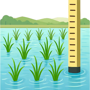
Flood
Fields are irrigated normally, water covers the paddy.
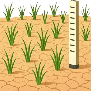
Dry
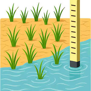
Water is withdrawn, soil is allowed to breathe and release less methane.
Flood again
The cycle repeats throughout the growing season.
Cycle
Flood
Fields are irrigated normally, water covers the paddy.
Dry
Water is withdrawn, soil is allowed to breathe and release less methane.
Flood again
The cycle repeats throughout the growing season.
Built by jidienne.com